Day 478 HOUSE from HELL Update

You know how you have a picture in your mind of how a holiday is going to go?  I did for Valentine’s Day.  I was making Chicken Cacciatore ala Slow Cooker and the perfect Tiramisu cake.  We were going to have a nice bottle of Peach Moscato to go with our salad.  We were going to have an easy day because of the incoming rain, stay in, watch a movie and enjoy each others company.

Well, Mother nature had another plan!

I had just started the slow cooker with dinner and was sitting down to have my second cup of coffee before I went to shower.  The rain started dumping in buckets and the winds picked up beyond belief – so much so that I moved to the other side of the room and away from my favorite windows because the wind was actually a little scary. Tornado warnings started coming across my phone fast and furiously abut that time and then I heard water pouring into my laundry area through the ceiling.  If that wasn’t bad enough, water also started pouring in through the window I had just moved away from.

Wasn’t much we could do besides grab a bunch of towels and wait it out. I did call the roofer to put him on alert.

Once the worst was over, hubby went up into the attic to assess the damage and the roofer showed up almost immediately to replace the shingles and fix the roof.  That was the easy part.

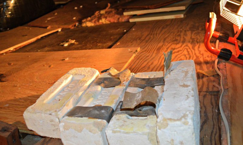
Fortunately we had just recently bought a new box of contractor heavy duty bags. We then spent yesterday in the attic trying to clean up the mess of wet insulation.  Up until now we had pretty much ignored the attic because we didn’t plan on using it, only clearing away around the opening and air conditioning area, but yesterday we found some really odd things up there.  The bricks we found were the oddest things.  We also found some disassembled OLD, and I do mean OLD cabinets, disassembled bookshelves, old paneling as well as a “roll” of 40 year old linoleum.


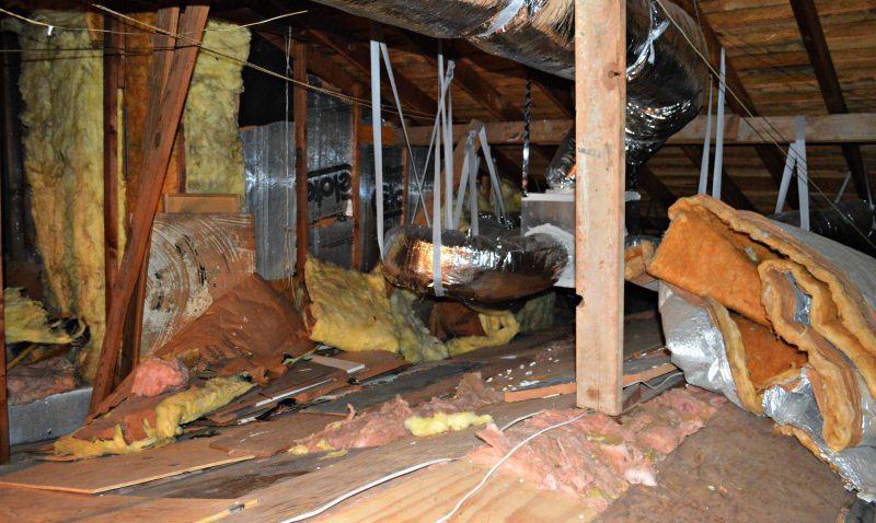
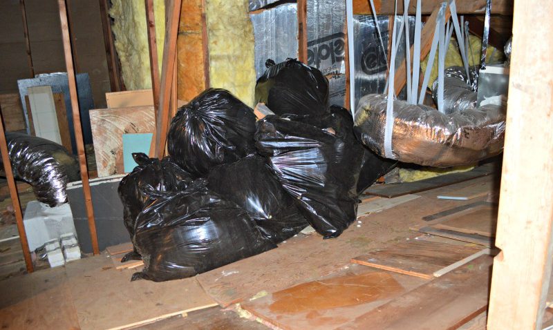
Compared to other areas around town that were hit with the “tornado weather”, we got off easy.  Just a bunch of clean up and repair, but no real substantial loss besides our time. Seven 55 gallon bags later we called it a day and showered BIG time!

We spent today dealing with the window leak. It’s a 40 year old window that was installed into a brick wall 40 years ago without any insulation or flashing.We have completed the inside repairs and after a bit more dry out will also seal everything from the outside.

Fortunately, we were home when this all happened and were able to get the church pew and great grandma’s quilts away from the leak.

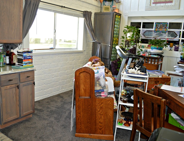
On the up side I was able to get the spice cabinets organized and cleaned up.


Save

Save

Freaky Weather and House Update

Oh so much better!


We ran about 2 boxes short of finishing the “old” side of the kitchen and doing all the ‘hand cut’ pieces before the crown molding.

The dining room is done except for edge pieces that need to be handcut.

I was trying to keep my sense of humor while I did inside projects to stay out of the weather and get over my bronchitis. That’s the glue on the back of one of the ceiling tiles.

I loved how the snow was sticking to the light pole in a straight line. This was really wet snow and with the wind blowing was al over the place. I love this tree across the street. It always makes me think Christmas ~ even in mid April.
This was the 3rd time he’d shoveled the driveway in the last 24 hours. I had to laugh this time ~ just after he finished the plow came by and did the street and he had to do the bottom all over again.
final blog signature.

Is it really spring?

It just keeps getting better and better – NOT – LOL – now they added wind, centered it directly over us and increased the amount of snow tonight…
EXPECT PERIODS OF WET SNOW TO CONTINUE THROUGH TUESDAY AFTERNOON AND FALL HEAVY AT TIMES. BY THE TIME THE SNOW ENDS TUESDAY EVENING… EXPECT A STORM TOTAL SNOWFALL OF … 14 INCHES. THE HEAVIEST SNOW IS MOST LIKELY OVER HIGHER TERRAIN NORTH OF CRYSTAL FALLS AND IRON RIVER. THE COMBINATION OF THE WET HEAVY SNOW AND WIND GUSTS OF 15 TO 25 MPH TONIGHT INTO TUESDAY COULD DAMAGE TREES AND PRODUCE POWER OUTAGES.
final blog signature.

Enough is enough already…

Enough is enough already. I signed on to check out this week’s weather and the bright flashing winter storm warning caught my eye. Needless to say, I am less than thrilled with reading this… THE LIGHT SNOW ON MONDAY MORNING WILL TRANSITION TO A HEAVY… WET SNOW MONDAY AFTERNOON AND CONTINUE THROUGH TUESDAY MORNING. THE SNOW MAY BE MIXED WITH RAIN AT TIMES THROUGH TUESDAY MORNING… ESPECIALLY OVER THE LOWER TERRAIN. BY THE TIME THE SNOW ENDS TUESDAY AFTERNOON… LOOK FOR STORM TOTAL SNOWFALL AMOUNTS OF UP TO AND AROUND A FOOT INTO TUESDAY AFTERNOON THE HEAVY WET SNOW COULD DAMAGE TREES AND PRODUCE POWER OUTAGES.
I’m glad we still have indoor projects to do!
final blog signature.

Thank Goodness today's project keeps me Indoors

From weather.com:
ARCTIC HIGH PRESSURE DROPPING FROM CENTRAL CANADA INTO THE PLAINS STATES WILL BRING A REINFORCING SHOT OF BITTER COLD AIR INTO THE UPPER GREAT LAKES REGION THROUGH THURSDAY. THIS BITTER COLD AIR MASS ALONG WITH AN INCREASE IN NORTHWEST WINDS THIS AFTERNOON WILL DRIVE WIND CHILL VALUES INTO THE 25 TO 35 BELOW ZERO RANGE OVER WEST AND CENTRAL UPPER MICHIGAN. EXPECT WIND CHILL VALUES TO TUMBLE INTO THE 35 TO 45 BELOW ZERO RANGE TONIGHT AND THURSDAY MORNING AS THE CORE OF THE ARCTIC AIR MASS DRIFTS OVERHEAD. I’m sure glad I don’t have to leave the house today, my boots are only rated to 30 below – LOL. I think I’ll go get another cup of coffee.

final blog signature.

NOT what you want to sign on to see… Wait, I'm not ready!!! I need another couple weeks…

Special Weather Statement for Iron County, MI

Issued by The National Weather Service
Marquette, MI
3:42 pm CDT, Wed., Oct. 22, 2008

STRONG WINDS AND SIGNIFICANT SNOW POSSIBLE ON SUNDAY INTO MONDAY MAINLY OVER NORTHWEST UPPER MICHIGAN…

A STRONG COLD FRONT WILL CROSS UPPER MICHIGAN ON SATURDAY NIGHT… USHERING A CHILLY CANADIAN AIRMASS INTO THE GREAT LAKES. EXPECT NORTHWEST WINDS IN THE WAKE OF THIS FRONT TO GUST AS HIGH AS 45 MPH OVER PORTIONS OF UPPER MICHIGAN… ESPECIALLY THE KEWEENAW PENINSULA ON SUNDAY.

AS THE COLDER AIR RUSHES IN BEHIND THE FRONT OVER THE RELATIVELY WARM WATERS OF LAKE SUPERIOR… LAKE EFFECT RAIN AND SNOW SHOWERS WILL DEVELOP SATURDAY NIGHT AND PERSIST THROUGH MONDAY. THE SHOWERS WILL BE MOST NUMEROUS IN THE NORTHWEST WIND SNOW BELTS OF WESTERN UPPER MICHIGAN AND EAST OF MARQUETTE. PLAN ON THE BEST CHANCE OF A SIGNIFICANT PLOWABLE LAKE EFFECT SNOW LATE SUNDAY INTO MONDAY OVER THE HIGHER TERRAIN OF INTERIOR WESTERN UPPER MICHIGAN FROM PELKIE TO WATTON… BRUCE CROSSING… PAINT LAKE AND MARENISCO.

final blog signature.

Isn't it SPRING yet?

Now they’re adding wind? This just gets better and better – will spring ever get here?

…RAIN SHOULD BEGIN BY MID EVENING… MIXING WITH AND CHANGING OVER TO ALL SNOW BY DAYBREAK FRIDAY. WINDS GUSTING TO 30 MPH WILL BE POSSIBLE THROUGH FRIDAY NIGHT…ACTING TO REDUCE VISIBILITIES TO NEAR A MILE OR LESS AT TIMES. THE STRONGEST WINDS ARE FIGURED NEAR LAKE SUPERIOR. STORM TOTAL SNOWFALL AMOUNTS OF 7 TO 10 INCHES ARE EXPECTED BY THE TIME THE HEAVY WET SNOW EXITS SATURDAY AFTERNOON…

I was asked this morning if the barn in the above picture was ours… I wish, but nope not that one – I just LOVE old barn pictures. This one is ours:


Hubby is thinking of turning it into a work shop… maybe…

Just when we were starting to see patches of grass – there's a Spring Blizzard


THE NATIONAL WEATHER SERVICE IN MARQUETTE HAS
CONTINUED A WINTER STORM WARNING…

EXPECT SNOW TO FALL HEAVY AT TIMES THROUGH THE NIGHT…WITH SNOWFALL RATES OF 1 TO 2 INCHES PER HOUR POSSIBLE IN BETWEEN LULLS IN THE PRECIPITATION. BY THE TIME THE SNOW ENDS BY TUESDAY AFTERNOON…PLAN ON STORM TOTAL SNOWFALL OF 9 TO 13 INCHES. IN ADDITION…GUSTY NORTH WINDS WILL CREATE SOME BLOWING AND DRIFTING SNOW IN OPEN AREAS.

A WINTER STORM WARNING MEANS SIGNIFICANT AMOUNTS OF SNOW ARE EXPECTED OR OCCURRING. STRONG WINDS ARE ALSO POSSIBLE. THIS WILL MAKE TRAVEL VERY HAZARDOUS OR IMPOSSIBLE.

Severe Weather Alert ~~I AM SO READY FOR SPRING!!

LOOK FOR WET SNOW TO DEVELOP AROUND NOON ON MONDAY AND BECOME HEAVY AT TIMES LATE MONDAY AFTERNOON THROUGH MONDAY EVENING. SOME OF THE SNOW MAY MIX WITH SLEET SOUTH OF POWERS. EXPECT THE PRECIPITATION TO DIMINISH AFTER MIDNIGHT MONDAY NIGHT. TOTAL SNOWFALL ACCUMULATIONS OF 8 TO 12 INCHES ARE POSSIBLE (and I was just starting to see patches of grass) FROM POWERS TO SAGOLA (next town north) AND IRON RIVER (next town west)…

A WINTER STORM WARNING MEANS SIGNIFICANT AMOUNTS OF SNOW OR SLEET ARE EXPECTED OR OCCURRING. STRONG WINDS ARE ALSO POSSIBLE. THIS WILL MAKE TRAVEL VERY HAZARDOUS OR IMPOSSIBLE.

~*~Blizzard~*~

The picture on the left was early this AM. The picture on the right was 5PM. Weather reports are predicting 1-2 inches per hour through the night and tomorrow morning with 40 mile an hour gusting wind. We’re staying home tonight with hot cocoa and snuggled in!